-
Mobile system for radiological search and monitoring purposes
-
Automatic radionuclides analysis with configurable library
-
Embedded gamma dose rate and spectrometry measurement units

Security Mobile Mapping Systems
All SyS Products
The Security Mobile Mapping Systems family provides integrated, deployable platforms for real-time radiological monitoring, mapping and situational awareness in security-critical environments. Designed for mobile, airborne and fixed deployments, these systems combine spectrometric detectors, georeferenced acquisition, onboard processing and cloud-based data fusion to support rapid decision-making during emergency response, border control, infrastructure protection and environmental monitoring operations.
At the core of the architecture is a distributed measurement network connected through the GAMON platform, which aggregates and analyzes data from multiple mobile units in real time. Embedded processing enables automatic radionuclide identification, dose-rate evaluation and configurable alarm logic directly on the field units, while centralized cloud visualization and control allow operators to coordinate large-scale monitoring campaigns and respond efficiently to complex radiological scenarios.
-
Integrated mobile, drone and fixed mapping systems for real-time radiological and neutron monitoring
-
Automatic isotope identification, dose-rate measurement and programmable alarm logic with georeferenced data
-
Centralized cloud platform for multi-system data fusion, visualization and remote configuration
Security Mobile Mapping Systems Models
Grid
Compare
GAMON-Drone
GAMON-D
-
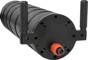
Gamma dose rate monitoring system embedding two energy compensated Geiger–Mueller (GM) detectors
-
Onboard web interface for easy configuration
-
Wide measurement range from 10 nSv/h to 10 Sv/h with subtraction of intrinsic background
GAMON-Diver
-
Monitoring of the water basins around nuclear power plants, as lakes, rivers, or sea
-
Monitoring of drinking water sources, at the extraction or purification points
-
Control of the TENORM content in the waste of industrial processing facilities and monitoring of the pipes for Oil&Gas transportation
GAMON RADLITE
-
Gamma radiation spectroscopy system based on scintillation detector
-
High detection efficiency for detecting small variation in background radioactivity during acquisition
-
Different crystal options available depending on the desired resolution or efficiency
New
GAMON-Mobile
-
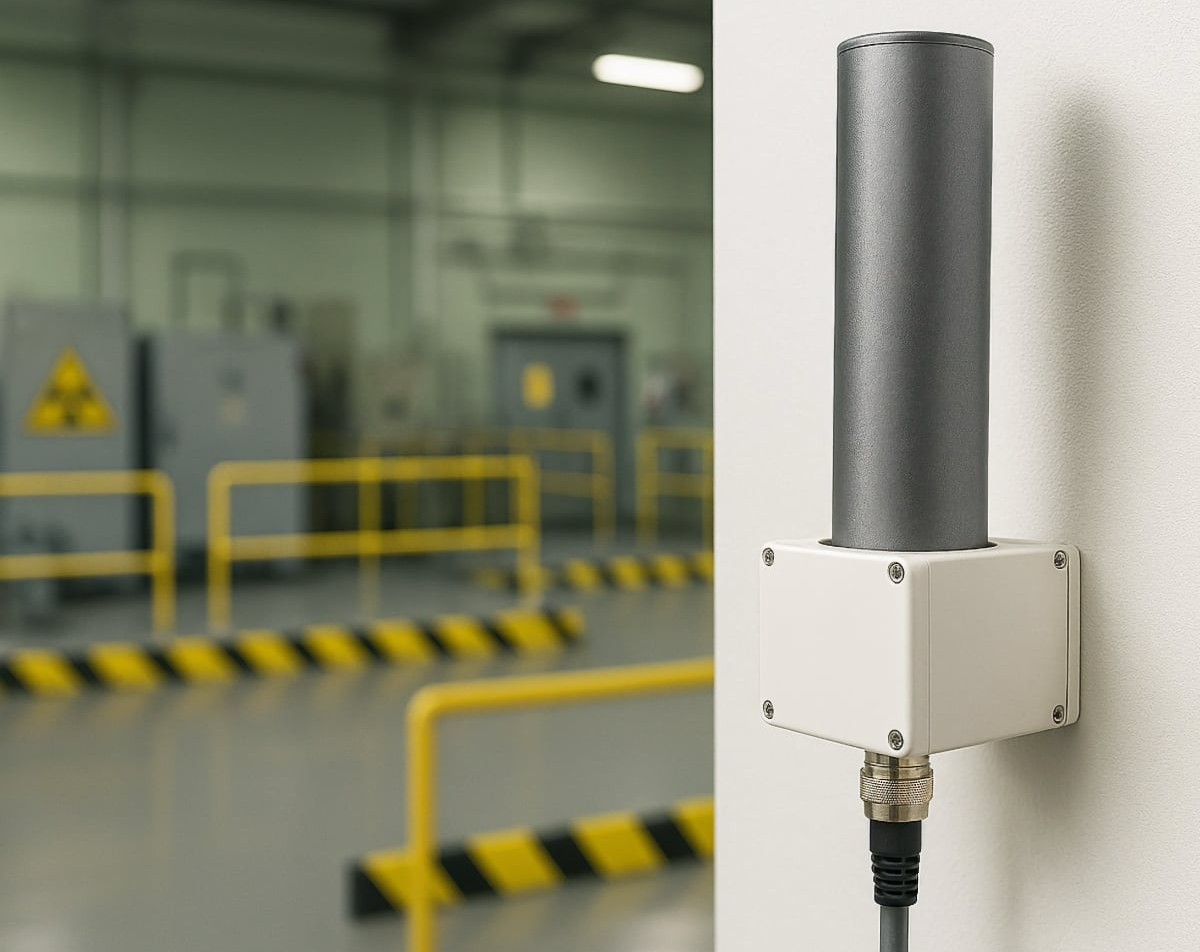
Discrete housing for outdoor monitoring in public areas
-
Spectroscopic and dosimetry probes for the identification of radionuclide gamma emitters
-
Neutron probe for detection of neutron emitters
Image |
Name
|
Event Protection |
First Responder |
Environmental Monitoring |
Nuclear Industrial Facilities |
Critical Infrastructure |
Access Point | |
 |
GAMON-Drone |
✓ |
✓ |
|||||
 |
GAMON-D |
✓ |
✓ |
✓ |
✓ | |||
 |
GAMON-Diver |
✓ |
✓ |
✓ |
||||
 |
New GAMON-Mobile |
✓ |
✓ |
GAMON Platform Benefits
The GAMON Platform can be tailored to specific customer needs, offering critical advantages and capabilities such as rapid deployment, multi-station network development and increased personnel safety and security, in compliance with international standards. These benefits are achieved by having easy, fast, secure, and reliable access to all real time measurements. Its intuitive graphical interface allows the user to fully monitor and control the detector system, guaranteeing rapid and well-founded decision making for a prompt response to emergencies.
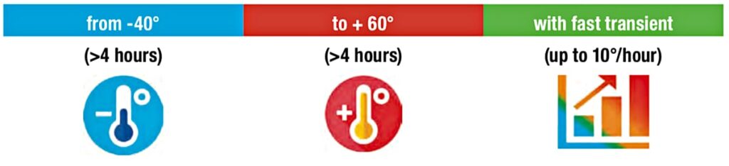
Stress Test Results
All the GAMON measuring systems are enclosed in a rugged case tailored for their use case scenario. The rugged case IP level range from IP66 to IP68 and it is designed for outdoor operation in extreme weather condition. Each GAMON system has been extensively tested in environmental chamber.
Automatic statistic analysis tool
The Automatic Statistical Analysis Tool enables users to perform customized searches of reports stored within the internal database by defining specific parameters, including start and end dates, status, and report type. It provides a clear visualization of key trends over time, such as the H*(10) dose associated with each identified isotope, the average scintillator count rate (ICR), the average Geiger-Müller (GM) dose rate, and, where available, rainfall data.
The system also features an automatic calibration tool accessible via a user-friendly web interface. Energy and Full Width at Half Maximum (FWHM) calibrations can be carried out quickly and reliably by simply positioning a calibration source near the probe and initiating the procedure. The software automatically detects spectral peaks and computes updated calibration curves for both energy and resolution, ensuring accurate and consistent measurements.
In addition, the platform includes a fully customizable isotope library designed in compliance with environmental monitoring standards. For each isotope, three configurable threshold levels – warning, alarm, and critical – can be defined. The system automatically calculates the H*(10) dose contribution of each identified isotope included in the library and reports it accordingly. The isotope database can be tailored to meet specific operational requirements, offering a high degree of flexibility to the user.
Web interfaced based software integrated in the gamon system
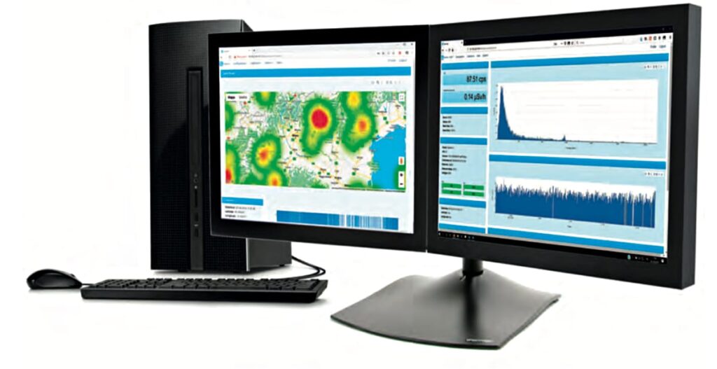
Each GAMON system is equipped with an embedded CPU running a dedicated web server application, known as GAMON Control Software, which eliminates the need for a central data server. Radiological data are securely stored both in an internal database and in non-volatile memory, ensuring continuous and autonomous data acquisition even in the event of connectivity loss.
The platform allows users to access spectra, acquisition reports, and historical data directly through a standard web browser, offering a straightforward and intuitive interface. Different user roles – such as user, technician, and administrator – can be defined, with fully customizable access levels to ensure appropriate control over system functionalities and data.
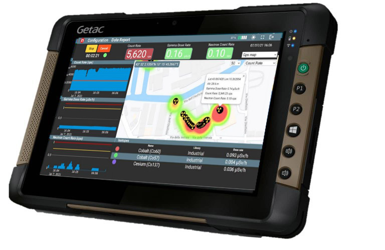
Spectral analysis and statistical data processing are carried out in compliance with ISO 11929 standards. The identification routines are based on an extended isotope library, enabling accurate recognition of selected radionuclides within stabilized spectra. The system continuously performs automatic diagnostics in real time, ensuring reliable operation and prompt detection of any anomalies.
Alarm management is fully configurable and can be tailored to specific isotopes, with rapid notification triggered by both spectral analysis and Geiger-Müller counting. Data security and system configuration are protected through password-controlled access, with flexible privilege settings for different user levels. Overall, the software provides comprehensive control over data acquisition and calibration processes, ensuring optimal performance and operational efficiency of the GAMON system.
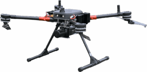
GAMON-Drone
Compact Radionuclides Identification Mobile Unit
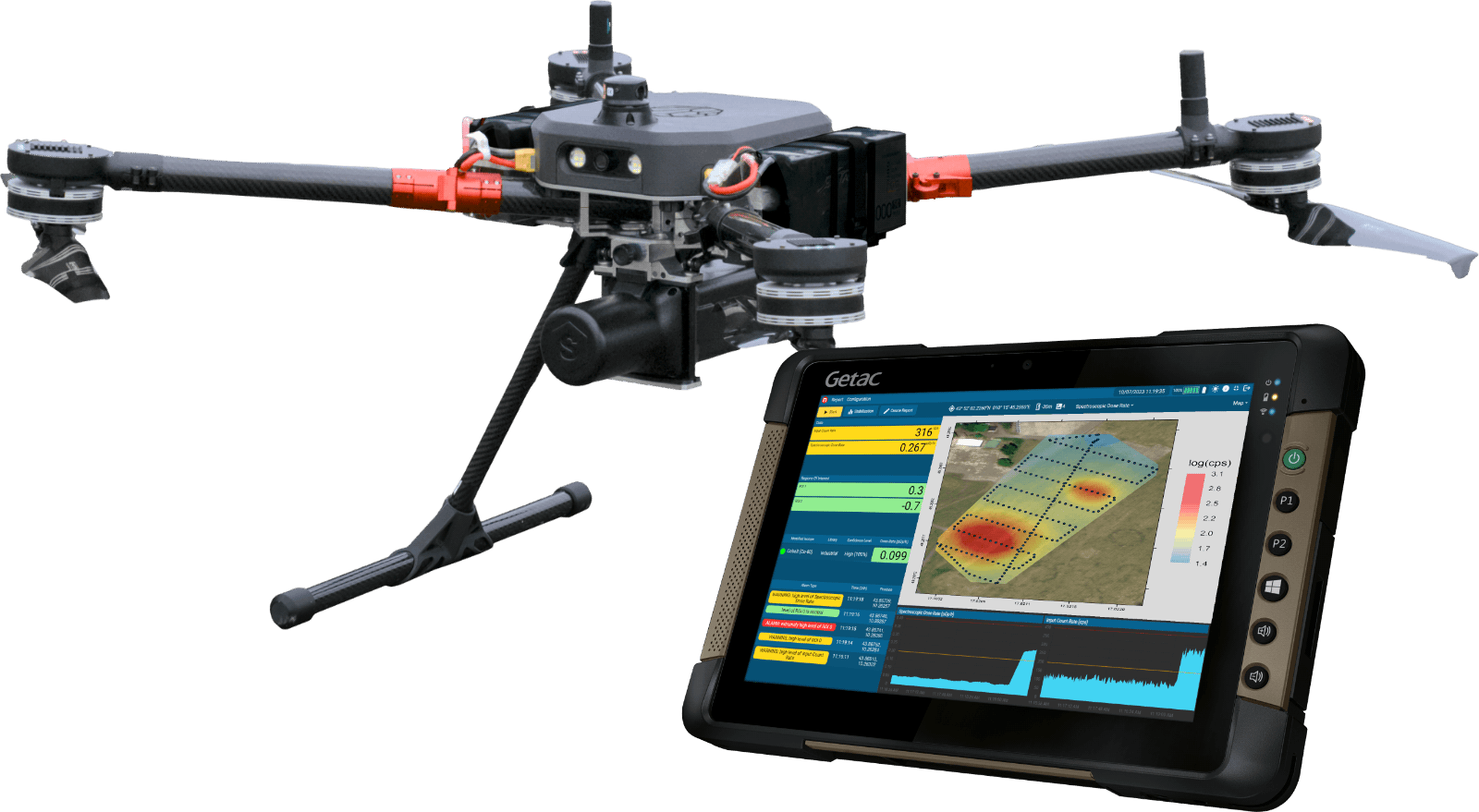
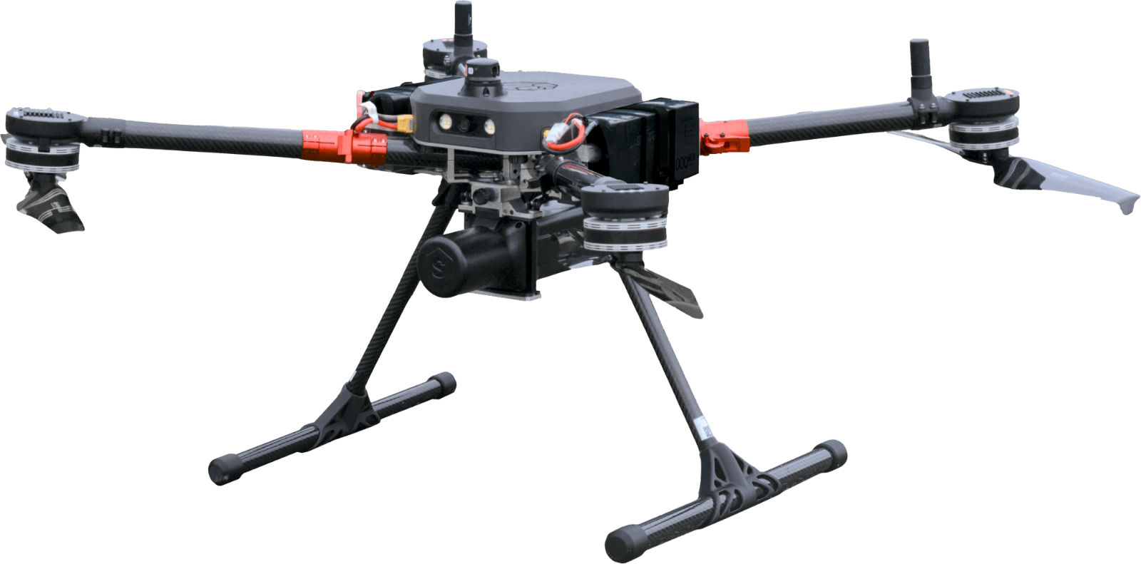
GAMON-Drone is a compact and independent system designed for radiological threat search. Weight and dimensions allow an easy installation on an UAV to conduct measurements over large areas to improve the operator safety or for access difficulties.
The GAMON-Drone measurement system integrates one spectrometer and one optional H*(10) dosimeter for gamma detection. The system is integrated in a rugged housing for outdoor environments with protection class IP65. It communicates wireless directly to the ground control station where a GIS map visualizes trajectory and measurements without affecting the UGV connections and performances.
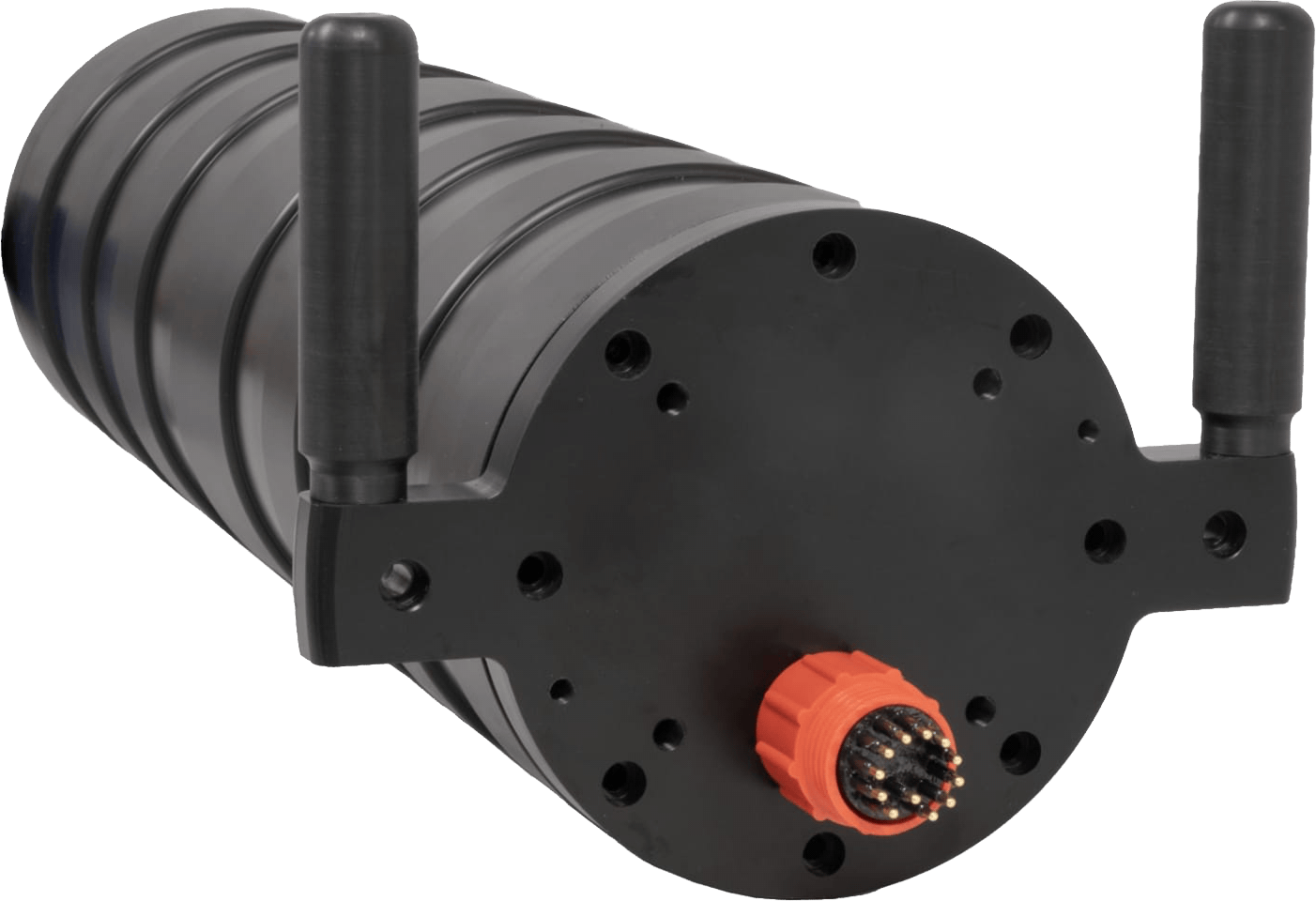
Gamon-Mobile
Vehicle Mountable Gamma Spectrometric Mapping System
GAMON-Mobile is a modular and vehicle mountable spectroscopy system with radionuclide identification and mapping features. GAMON-Mobile system is supplied in a rugged and IP66 container designed to resist to external stresses (e.g. shocks and vibrations) and easy to mount and fix on the vehicle chosen for the inspection (boat, helicopter or car).
It is designed to make radiometric measurement and identification of gamma emitters on wide areas providing a map of the radioactivity detected. The real time identification algorithm can recognize artificial gamma emitters beyond the natural background and mark the hot spot over the trajectory traveled by the moving vehicle. This feature allows the user to make a map of the radioactivity of the scanned area.
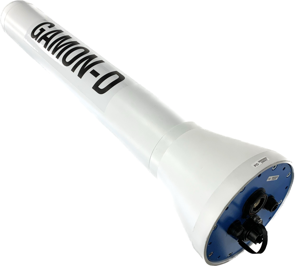
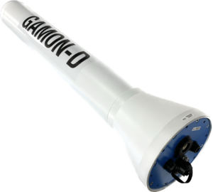
Gamon-Diver
Compact Underwater System for Radionuclides Identification
GAMON-Diver is a gamma spectrometer specifically designed for the detection of gamma-emitting isotopes in a range of critical applications, including accident mitigation, emergency response operations, and long-term monitoring of nuclear facilities as well as Oil & Gas infrastructures.
The system incorporates advanced spectral analysis algorithms capable of simultaneously identifying multiple radiological sources. In addition, it provides accurate quantitative measurements of both dose and radionuclide activity, supported by an integrated detector efficiency calibration.
Key features of the system include a pressure-resistant housing suitable for deployment at depths of up to 450 meters (45 atmospheres), marine-grade connectors and cabling designed for harsh underwater environments, and GPS integration for communication with a control computer located onboard or at the surface. The device is powered by an internal battery that ensures up to 8 hours of continuous operation.
Footer